« back to childhood | Main | All of a sudden... »
June 28, 2005
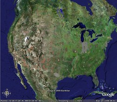
Google Indiana
Google Indiana
Originally uploaded by josh.ev9.
So I was playing with Google Earth today and I noticed that the state of Indiana is grey. Why is that?
My suspicion is that Indiana has more detailed maps than the rest of the country. When you take a satellite picture close to the ground it is likely that there is more grey than green in any given shot. The green on the map is due to artificial coloring in areas that are not yet imaged up-close. Any other guesses?
Mad props to Indiana for being well mapped. Woo woo.
Posted at June 28, 2005 10:53 AM